Good news to all bikers! Google has added the new biking directions feature and extensive bike trail data to Google Maps. Currently, the biking directions is available only for the United States.
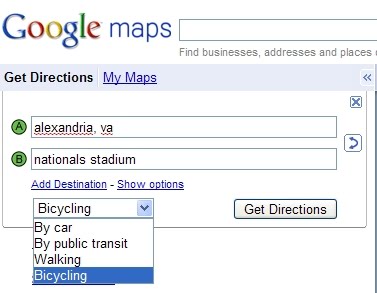
This is what the Google Maps team has to say about their latest feature :
… we wanted to include as much bike trail data as possible, provide efficient routes, allow riders to customize their trip, make use of bike lanes, calculate rider-friendly routes that avoid big hills and customize the look of the map for cycling to encourage folks to hop on their bikes. So that’s exactly what we’ve done.
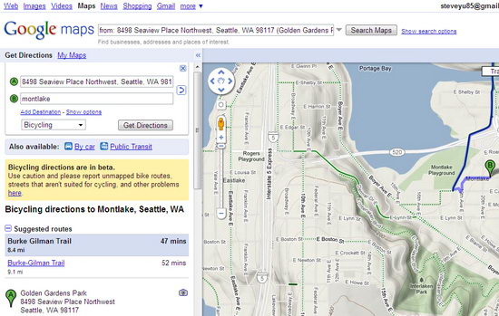
With the latest biking directions feature, you can use Google Maps to :
- Get turn by turn biking directions
- See trails and bike lanes directly on the map
- Drag and drop points to customize your route
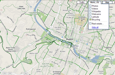
When you’re zoomed into a city, click on the “More” button at the top of the map to turn on the “Bicycling” layer. You’ll see three types of lines appear on the map:
- Dark green indicates a dedicated bike-only trail;
- Light green indicates a dedicated bike lane along a road;
- Dashed green indicates roads that are designated as preferred for bicycling, but without dedicated lanes
To try this new feature, simply head over to http://maps.google.com/biking.


